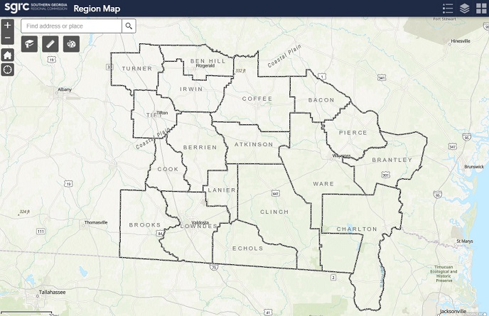
SGRC Region Interactive Map
A searchable map of counties, cities, and roads in the Southern Georgia region

SGRC Regional GIS

Geography matters to all of us. What we each know about our geography makes a difference in the decisions we make each day: which route we take to work, where we vacation, where we shop, and where we choose to live. Each one of us knows something useful about our geography. Sharing what you know with someone can impact the decisions they make too.
Expanding on that principle, our local governments deliver vital services such as public safety, utilities, sanitation, elections, community development, recreation and the list goes on. These are tasks that are taken seriously and it calls for the best information in order to make the best decisions. Access to geographic information is just a click away on desktops and mobile devices around the local governments' offices. This gives hundreds of decision-makers and staff around our community access to a variety of geographic information. Just about anything you might run across in your daily travels across our community has been mapped and is being maintained in the Regional GIS database.
A searchable map of counties, cities, and roads in the Southern Georgia region
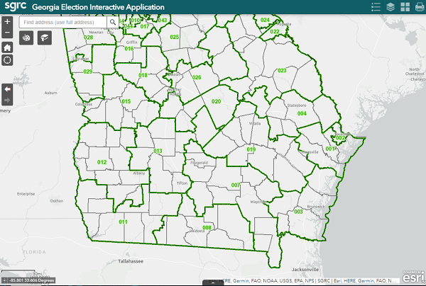
View and Search for Georgia State Districts and Voting Precincts
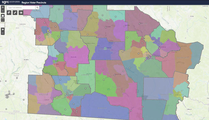
View and search for Voting Precincts
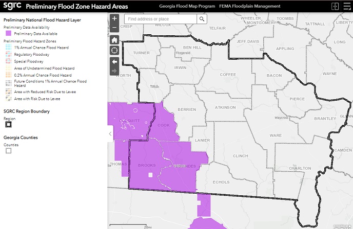
A searchable map of counties and cities in the Southern Georgia Region that displays the current FEMA Flood Hazard areas and any preliminary flood hazard data.
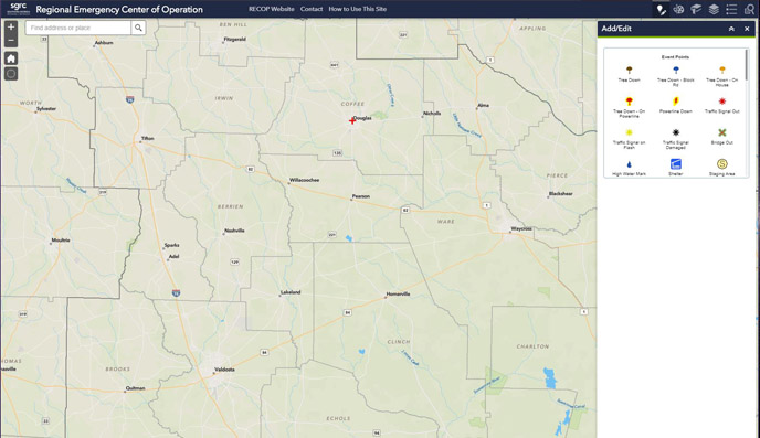
A map for local governments and emergency management personnel to use during severe weather and disaster situations
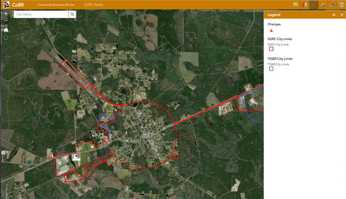
A map for local governments to review city limit boundaries reported by the Census Bureau vs. the SGRC boundaries. The U.S. Census Bureau conducts the Boundary and Annexation Survey (BAS) annually to collect information about selected legally defined geographic areas. BAS is used to update information about the legal boundaries and names of all governments. SGRC GIS can help you navigate the BAS process. Please contact us for further information.

Click here for the survey or use the QR Code.
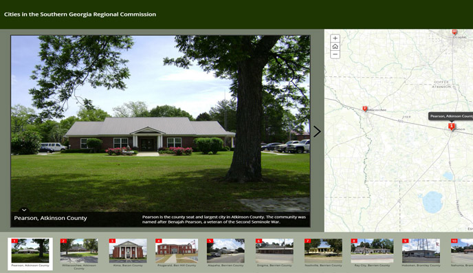
Take a tour of cities around the SGRC Region
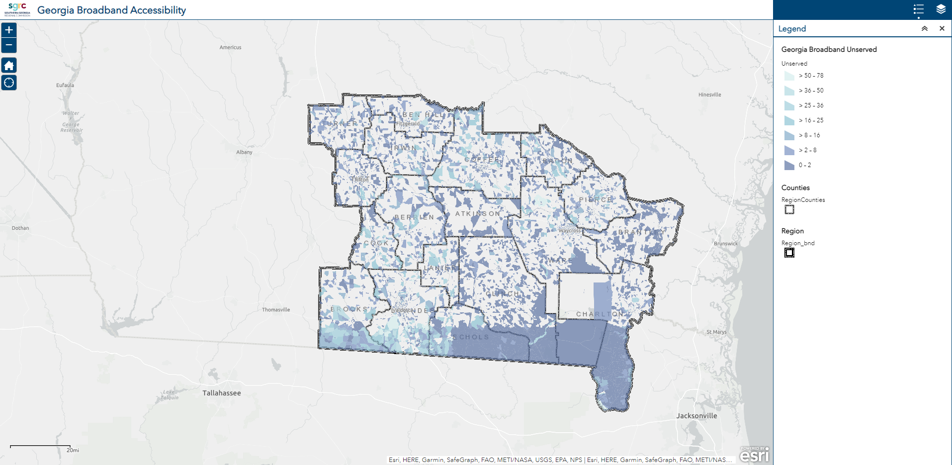
A map for local governments to review Georgia Broadbands served and unserved areas for our region. Broadband data is provided by the various Internet Service Providers of Georgia. Statistics are based on a fixed, terrestrial broadband definition of 25 Mbps down and 3 Mbps up, and where the broadband service is available to more than 80% of locations in a census block. Census blocks that did not meet this definition are delineated as 'Unserved'. The map depicts access to broadband, not subscription to broadband.